ARTICLE AD BOX
Last Updated:October 30, 2025, 09:07 IST
IMD weather forecast: The Bay of Bengal turns active again, brewing a new low-pressure system that could impact Andhra Pradesh and Telangana in the coming days
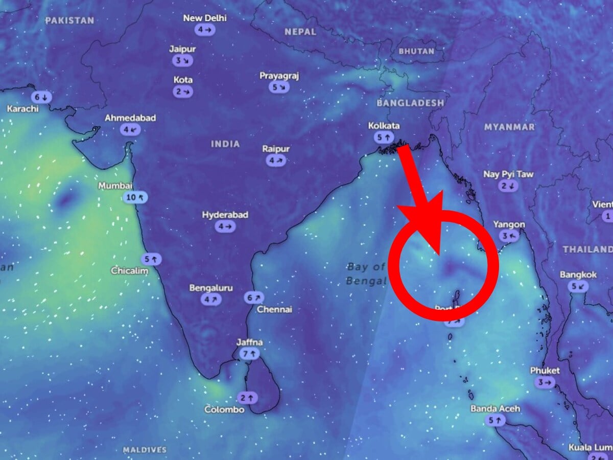
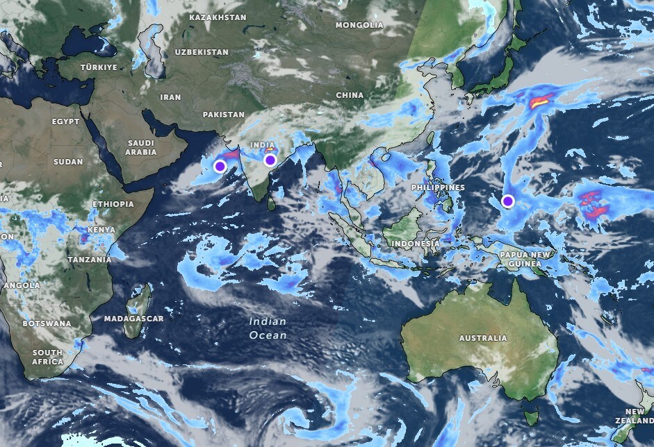
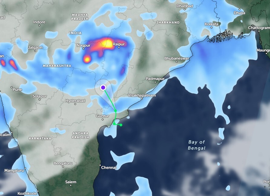
The Bay of Bengal has turned active once again, triggering the development of a fresh low-pressure system. Meteorologists report that a strong trough over the region is likely to intensify into a depression by October 31. A new low-pressure area is likely to form on November 1 in the eastern Bay of Bengal, near Thailand, and gradually move westwards. If it continues on this track, it could reach Guntur in Andhra Pradesh.
However, its exact path remains uncertain, and it is still unclear whether it will persist as a low-pressure system or intensify into a cyclone. For now, there is no cause for concern, although it is always wise to stay prepared, especially for farmers, who should take necessary precautions.

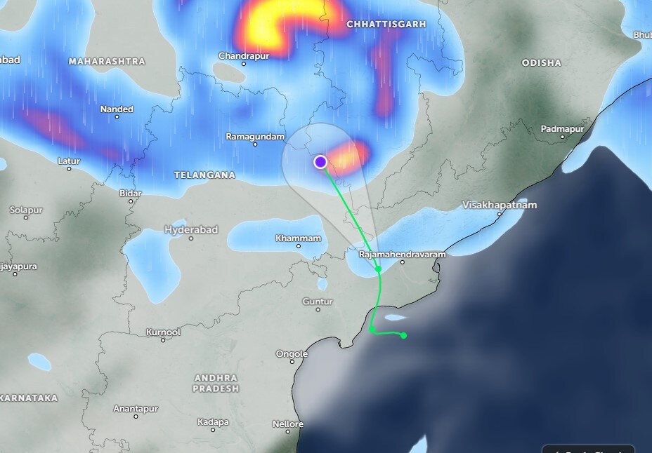
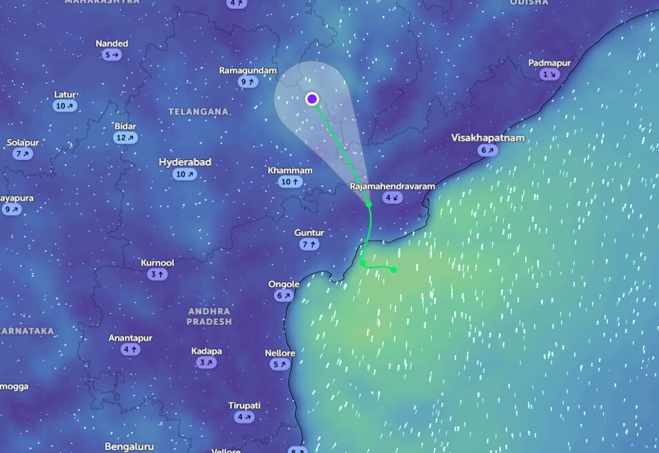
Cyclone Montha has weakened considerably and is now moving as a depression, with wind speeds around 45 km per hour. It is expected to continue losing strength as it moves towards Chhattisgarh on October 30. Hence, Andhra Pradesh is unlikely to experience any major impact, whereas Telangana is likely to see heavy rainfall.
")
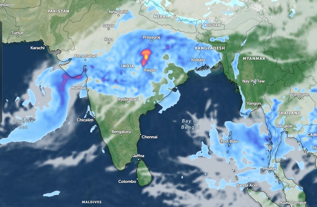
According to the India Meteorological Department (IMD), southern states are expected to receive the most rainfall across the country on October 30. Telangana, coastal Andhra Pradesh, and Yanam are likely to experience light to moderate rainfall in several places and heavy showers in isolated areas.
")
In Telangana, gusty winds blowing at 30-40 km per hour, along with thunder and lightning, are expected. Rayalaseema too may witness thunder and lightning on October 30, while coastal Andhra and Yanam will experience similar conditions on October 31.
Live satellite imagery suggests that light to moderate rain will occur in many parts of northern Telangana throughout the day, with a few locations experiencing heavy showers. The skies across Telangana will remain cloudy, though rainfall seems to be tapering off. Hyderabad is expected to remain dry on October 30, providing motorists with some respite. Southern Telangana may even see a few sunny intervals.
In Andhra Pradesh, scattered showers are expected in northern coastal regions from morning till night, while parts of the coast may receive rainfall until the evening. Rayalaseema will remain mostly dry with sunny weather likely in the afternoon across both Rayalaseema and coastal areas. Overall, residents of Andhra Pradesh can expect a break from the persistent rains on October 30.
Meanwhile, an air mass over the Arabian Sea near Gujarat is currently moving at around 45 km per hour and is expected to weaken into a low-pressure system later on October 30. Its influence may extend slightly into western Telangana by November 1. Wind speeds in the Bay of Bengal stand at around 21 km per hour, while Andhra Pradesh and Telangana will experience winds of approximately 11 km per hour and 16 km per hour, respectively.
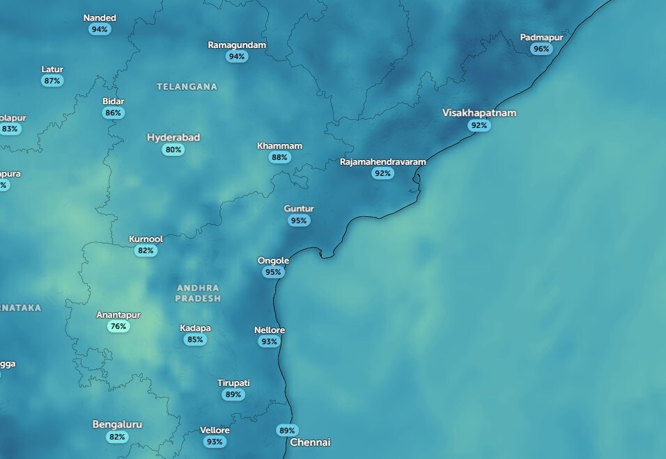
Temperatures are expected to rise again, reaching around 30°C in Telangana and 32°C in Andhra Pradesh. Daytime humidity will be around 57% in Telangana, 85% in northern Telangana, 63% in Andhra Pradesh, and 85% in northern Andhra. At night, humidity levels will rise to about 80% in Telangana and 95% in Andhra Pradesh, which could bring moderate rainfall or isolated heavy showers during the night.
On a broader scale, atmospheric activity has picked up across Asia, the equator, and even Antarctica. Wind speeds in the Indian Ocean have nearly doubled, with strong gusts from Antarctica moving northwards towards the equator, causing turbulence and rapid cloud formation. Cloud activity has been increasing near the equator over the past two days, and new systems are developing across East Asia. This suggests that rainfall is likely to continue into the first week of November.
News Photogallery india AP, Telangana Weather Update: Fresh Low Pressure In Bay Of Bengal, IMD Predicts Heavy Rain


 English (US) ·