

.png)
.png)
.png)
.png)


 10 hours ago
3
10 hours ago
3
ARTICLE AD BOX
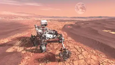
Exploring Mars has long been one of humanity’s greatest scientific dreams. And with each exploration in space, we get a little closer to answering some of our biggest questions, like did life ever exist on Mars? Could humans live there one day? What secrets are hidden beneath its red surface?One among these space rovers sent for planetary research is NASA’s Perseverance rover, which stands out as one of the most advanced ever built.
Since landing on Mars in 2021, it's been driving across the dusty terrain, conducting experiments, collecting rock samples, and sending back images that let us see Mars like never before.
Stunning shot captured by Perseverance
NASA’s Perseverance rover captured one of the clearest, sharpest panoramas ever on Mars. The Mastcam‑Z instrument took 96 separate images at a site nicknamed “Falbreen”, which were later stitched together to form a 360° view of the landscape.
This milestone occurred on the mission’s 1,516th Martian day, or sol.What set this panorama apart was the stunning clarity of the skies, practically dust-free, giving an exceptionally clear view of the terrain. The enhanced-colour version even gives the sky a deceivingly blue hue, although a natural-colour version shows its familiar reddish tone, according to the NASA Jet Propulsion Laboratory.

Changed-colour view of an area on Mars nicknamed 'Flabreen' for better comprehension, captured by NASA's Perseverance Mars rover on 26 May 2025. Credit: NASA/JPL-Caltech/ASU/MSSS
What is seen in the image?
Among the landscape’s standout features is a large “float rock” that appears placed at the top, along with a dark, crescent-shaped sand ripple, located about 4.4 meters from the rover.
Scientists believe the rock originated elsewhere and arrived before the sand ripple formed.Nearby, a bright white abrasion patch, about 5 cm wide, marks the 43rd rock Perseverance has worn down with its drill. This spot allows the team to examine the rock’s interior before deciding to collect a core sample. The abrasion occurred on May 22, with follow-up analyses conducted two days later.You can trace the rover’s journey through its tracks seen on the right side of the panorama.
About 90 meters (300 feet) away, they curve toward a previous site called “Kenmore”.
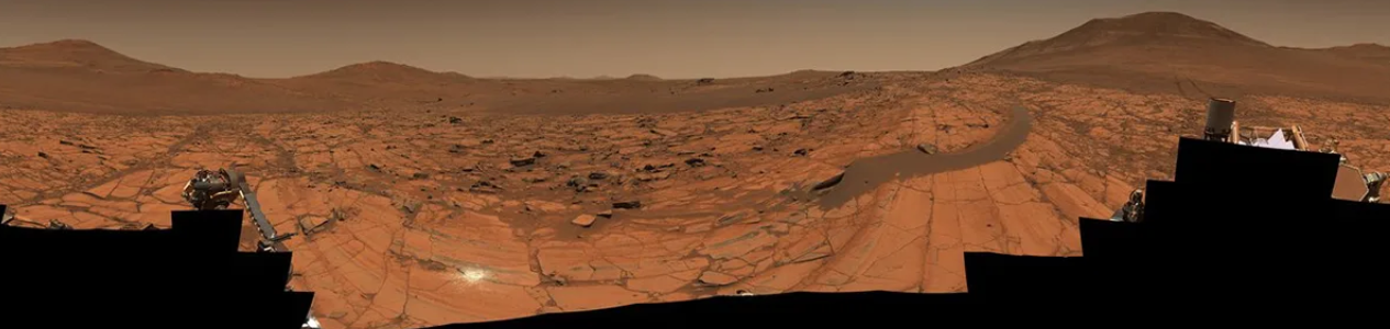
The panorama also reveals a clear boundary between two geological zones. The rocks closer to the rover are light-toned and rich in olivine, while darker, clay-bearing rocks farther off appear much older. Scientists are particularly excited because Falbreen may be part of the oldest terrain explored by Perseverance, potentially even predating the rim of Jezero Crater, according to NASA.This image isn’t just visually stunning; it's scientifically valuable. By highlighting geological contrasts and providing exceptional clarity, it’s helping researchers find out Mars’ deep past and refine our understanding of its surface.


 English (US) ·