 5 days ago
9
5 days ago
9
ARTICLE AD BOX
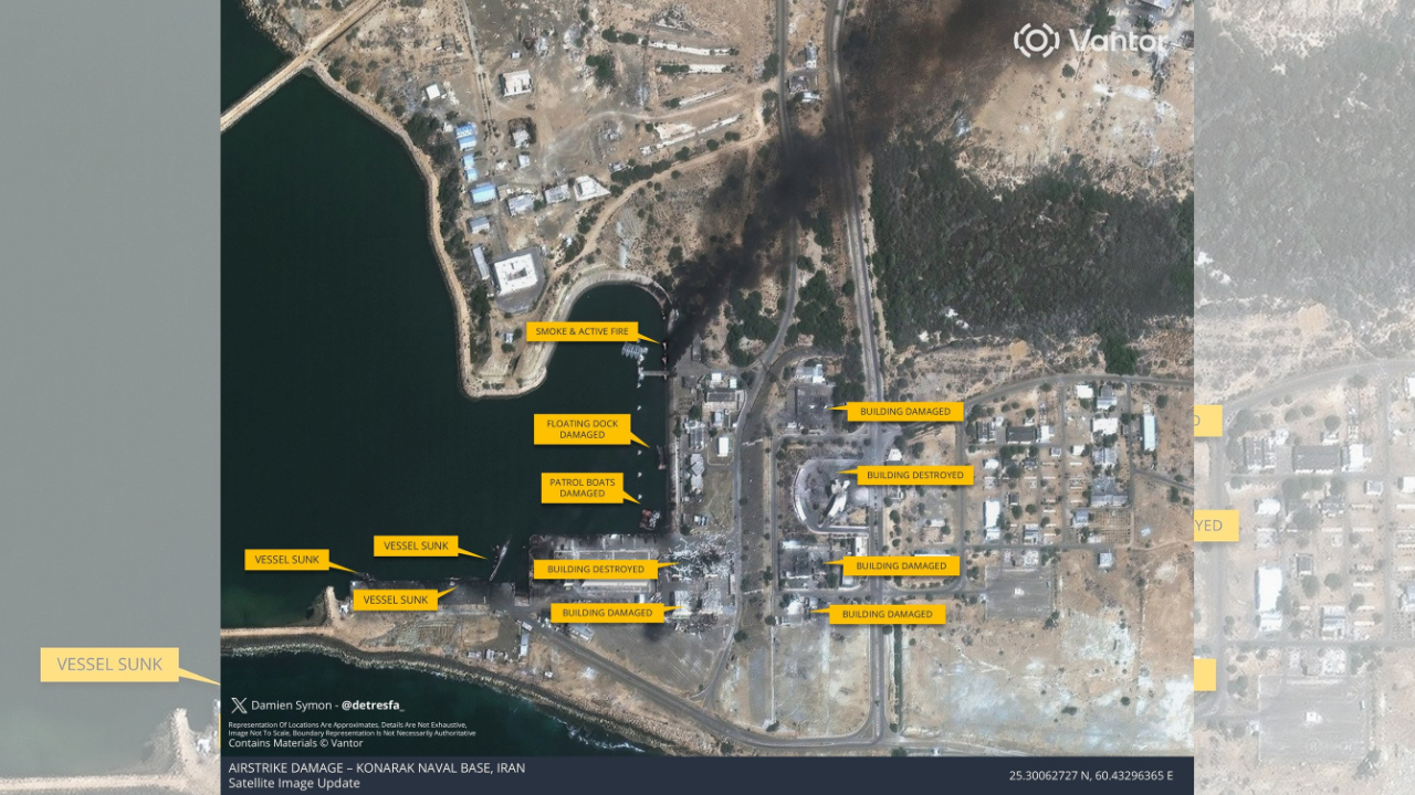
Recently released commercial satellite imagery showed extensive damage at multiple Iranian military installations, including air, drone and naval facilities near the strategic port city of Konarak.
The damage was done following the latest round of strikes as fighting between Iran, Israel and the United States intensifies.The images, collected by US spatial intelligence firm Vantor and distributed via Associated Press, indicate precision strikes on hardened military infrastructure along Iran's southeastern coast on the Gulf of Oman. Iranian authorities have not released an official assessment of losses or operational impact.
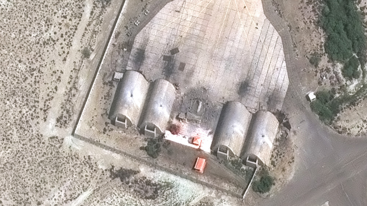
At Konarak airbase, satellite frames show several hardened aircraft shelters bearing dark burn marks and apparent structural damage on their roofs and surrounding areas. Adjacent operational zones also appear affected, while runway sections remain largely intact in the imagery.
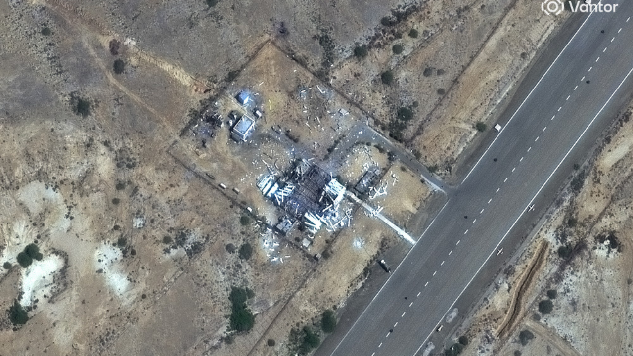
Nearby, images of a drone-related facility show multiple buildings collapsed, with debris scattered across the compound close to an airstrip.
Analysts comparing the images with earlier satellite references said the damage appeared extensive, with several structures either heavily degraded or destroyed.
Additional photo indicates strikes on what is being identify as fortified storage areas and bunker-like structures. Impact points and disturbed ground patterns are visible inside protected enclosures, suggesting direct hits, though the specific function of the facilities could not be independently verified.
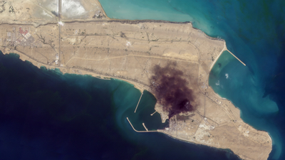
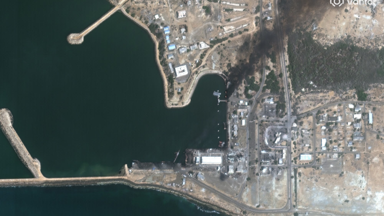
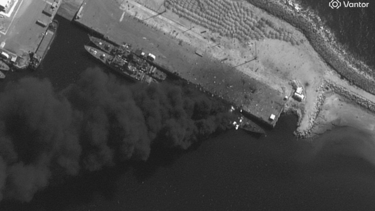
At a coastal naval complex in Konarak, satellite photographs show destruction to waterfront buildings and infrastructure near docking areas. At least two vessels visible in the harbour appear damaged or partially submerged compared with earlier imagery. The US military said on Sunday it had struck an Iranian Jamaran-class corvette in the area and that the vessel was sinking.
US president Donald Trump said the United States had destroyed or sunk nine Iranian naval vessels and would continue to target Iran's remaining fleet. The images also show damage at other sites across the country. At Zahedan airbase in eastern Iran, near the borders with Afghanistan and Pakistan, satellite imagery reveals what appears to be a destroyed radar system, potentially degrading Iran’s air defence and early-warning capabilities.The latest strikes mark a broader US involvement than earlier operations in June 2025, which primarily targeted Iran's nuclear facilities.
The current campaign appears to include air, naval, drone and radar assets.The satellite imagery has emerged as the conflict widens across the region. Iran has launched missiles towards Israel and parts of the Gulf, while Iranian-backed groups have claimed attacks on US and Israeli interests. Gulf states have reported incidents near major oil infrastructure, heightening fears of a wider regional escalation.Iran has vowed retaliation, while European governments have called for restraint and renewed diplomatic efforts.


 English (US) ·